

About Us
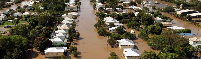
Garada is a proposed Australian led Formation Flying L-Band SAR satellite system that provides SAR imagery and interpreted data to primarily Australian end users for the purposes of soil moisture mapping, forest change detection, flood and disaster monitoring and bistatic research. It is aimed primarily at civilian applications but may also support defence.
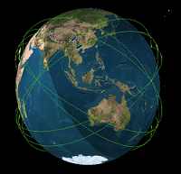
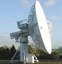
The system comprises two identical satellites flying half an orbit apart in a sun synchronous orbit of 630km altitude. The orbit repeat cycle of 6 days results in the whole of Australia being overflown every three days. The main payload is a high resolution L band Synthetic Aperture Radar that has a resolution of 4-11m in range and 7m in azimuth. A secondary payload is a Global Navigation Satellite System (GNSS) receiver designed to receive positioning and timing signals from multiple satellite navigation systems. The satellite is intended to be launched from the, Falcon 9 class launch vehicle. The design is based on Astrium's Snapdragon configuration and TerraSAR-L experience. The primary ground station for receiving the satellite data is located in Antarctica to provide good orbit coverage. The return of the received data to Australia uses the proposed Antarctic broadband link satellite data system. A secondary ground station in Tasmania provides additional orbit coverage and redundancy. The mission and payload operations and payload data processing are carried out in an operations centre located in Australia and staffed by Australian personnel.
The research within Garada is made up of 11 distinct work packages each led by an internationally recognised investigator. Individual work packages have the potential to generate new knowledge as "stand-alone" investigations, as well as feeding into the project's defined overall aims; meaning benefits will resonate beyond Garada.
Work Package 1: Space Systems Engineering and Radar Applications
The aim of Work Package 1 is to identify the users of the Garada environmental monitoring capability and determine their requirements. Using these requirements potential SAR/Satellite/formation/constellation concepts will be analysed and traded off in terms of their ability to meet requirements. Potential radar applications that may arise from these satellite systems will be investigated. Work Package 1 will also be responsible for the spacecraft systems engineering including CAD model and mass budget. Also this work package aims to develop business model for the whole Garada project.
Work Package 2: SAR Solution
The aim of Work Package 2 is to establish and develop the most suitable SAR techniques by considering geometries, configurations, signal processing, algorithms, hardware technologies, and specifications to meet requirements. Also Work Package 2 will define the baseline mission architecture based on users requirements identified in Work Package 1.
Work Package 3: SAR System Analysis
The aim of Work Package 3: SAR System Analysis is to trade-off the potential SAR system concepts in terms of their respective merits and ability to deliver the targeted user benefits/applications. Furthermore work package 3 aims to establish the top-level technical requirements specification for the SAR system.
Work Package 4: Bistatic Radar
The aim of Work Package 4: Bistatic Radar is to investigate the differences in the GNSS reflections returns experienced on a space-borne platform and the implications for design modifications to our proposed receiver for bistatic radar applications in space. This involves research into the new signal processing requirements.
Work Package 5: Prototype Receiver
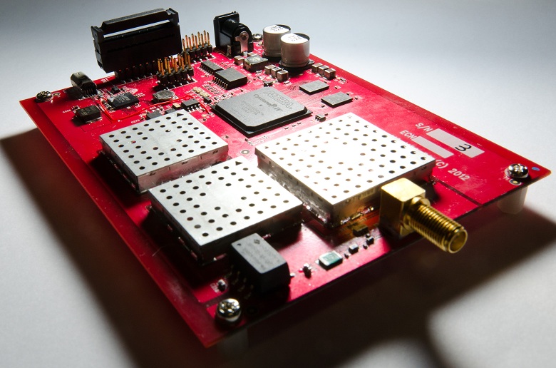
The aim of Work Package 5: Prototype Receiver will be to produce a complex L1/ E1/ L5/ E5 GNSS receiver for operation in space. Two receivers are proposed: i) a simple qualification of an existing Namuru design for flight on the first Bluesat mission, and ii) a more "professional" prototype for the SAR missions.
Work Package 6: Formation Flying Algorithms
The aim of Work Package 6: Formation Flying Algorithms is to develop models, methods and algorithms for precise formation-flying positioning. This work package also aims to demonstrate the formation flying capabilities using the GNSS carrier phase based positioning and attitude determination concepts. This implies adequately accounting for a wide range of error sources in the dynamic environment, as well as capturing the noise characteristics in a stochastic model.
Work Packages 7: Orbit Models
The aim of Work Package 7: Orbit Models is to examine the best orbit models for establishing the essential physical relationships between satellites. This includes examining the precision required for the injection phase and subsequent control manoeuvres in order to set up correct orbits. Also the period of time over which satellites can be expected to maintain a useful relative configuration before new manoeuvres are required will be investigated.
Work Package 8: Orbit Control Analysis
The aim of Work Package 8: Orbit Control Analysis is to establish ground /on-board interaction methods of maintaining the satellite constellation in the required spatial relationships based on those configurations defined in Work Package 1 and 2. Furthermore it is also the task of work package 8 to trade-off and define the overall concept and architecture for the attitude and orbit control system (AOCS) for the satellites in this constellation.
Work Package 9: Industrialisation Analysis
The aim of Work Package 9: Industrialisation Analysis is to establish a viable programmatic basis from which a full implementation project can be planned. Also this work package will review and determine the extent to which existing Australian industrial capability could contribute to such a program, identifying areas of niche capability, and potential gaps in requisite skills/expertise.
Work Packages 10: Ground Segment Study
The aim of Work Package 10: Ground Segment is to define the SAR constellation ground segment based on space segment concept and end user requirements. Also this work package aims to encompass Telemetry, Tracking and Control (TT&C) functionality and data transmission, processing, archiving and product distribution.
Work Package 11: Project Management
The aim of Work Package 11: Project Management is to be responsible for the management and system engineering of this project. This involves the planning, organising, communicating, tracking and reporting on all aspects of Garada. The project management team plays a fundamental role as there are a large number of different work packages involved in the project with involvement from numerous international partners. The interaction between studies is relatively high and hence system engineering, i.e. tracking and communicating changes in the overall system specifications, is a key task in this work package.